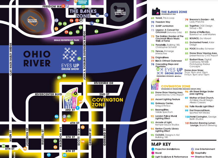
The BLINK festival map has been released. The map shows the location of 101 light sculptures, murals, installations, and live performances stretching from McMicken Avenue in Over-the-Rhine to 7th Street in Covington.
The four-night event is built around animated light projections and started in 2017.
The map divides the area into five zones — Findlay Market, Over-the-Rhine, Downtown, The Banks and Covington — and reaches from Broadway Street to the east, to Central Parkway to the west in Cincinnati, and from Scott Boulevard to Mainstrasse in Covington.
It shows the streetcar route and stops, along with the transit centers where park-and-ride shuttles will drop-off and pick-up passengers. Public bathrooms, hospitality booths, souvenir shops, and markets are also highlighted.
2022 BLINK map by WVXU News on Scribd
In 2019, the Roebling Suspension Bridge was closed to vehicular traffic and lit up. This year, the connecting piece between Covington and Cincinnati will be a drone show over the Ohio River. There will be two performances Thursday, Friday and Saturday evenings.
A digital copy of the map will be released Oct. 10.
BLINK starts Oct. 13 with a parade. Organizers say the route will be announced later this week.


